New Method to Measure Wind Speed Could Unlock Drones’ Potential, Say Eagle Researchers
 Mike Cavaliere
Mike Cavaliere
/
Mike Cavaliere
Oct 20, 2023, 8:24 AM
Traditionally, remotely piloted aircraft systems, or drones, have used onboard flow sensors to measure wind effects, producing in-flight metrics on which operators rely. Leveraging GPS instead, however, might provide more robust measurements, leading to safer, more efficient flights, according to Embry-Riddle Aeronautical University researchers.
As most drones weigh less than 55 pounds, even mild gusts of wind can disrupt their flight, which makes finding creative solutions to monitor and predict hyperlocal weather conditions essential to flying without disruption or unplanned landings.
Dr. Marc Compere, associate professor of Mechanical Engineering at Embry-Riddle’s Daytona Beach Campus, recently described a new approach to measuring wind effects — in the international, peer-reviewed Drones journal — along with Drs. Kevin Adkins and Avinash Muthu Krishnan, both professors of Aeronautical Science.
“The GPS method does not attempt to estimate thrust or drag forces,” said Compere, principal investigator on the project. “Using only GPS and orientation sensors, our new strategy estimates wind vectors in an Earth-fixed frame during turning maneuvers.”
“It's all about safety,” Adkins added. “The lower atmosphere is a new and incredibly dynamic portion of the environment for sustained aviation operations; traditionally, this is an area we have passed through quickly during ascent and descent. Wind poses unique challenges to controllability and the aircraft’s range and endurance.”
Ultimately, the team’s goal is to make the flight of uncrewed aircraft more predictable in locations that have never seen UAS flight, which will boost flight reliability and help advance the technology throughout the industry, from drone-based package delivery all the way to urban air mobility, or “air taxis.”
“People flying in electric aircraft like the Jetsons — no kidding, that’s in our near future, perhaps in the next decade,” Compere said.
But the implications of wind on uncrewed aircraft systems (UAS) extend far beyond piloting requirements. Scientists need accurate wind measurements to research atmospheric conditions and air quality; wind can offer emergency workers clues as to a wildfire’s growth patterns; and wind affects the weather.
“Sensing wind is a critical part of society that not many people are aware of,” Compere added.
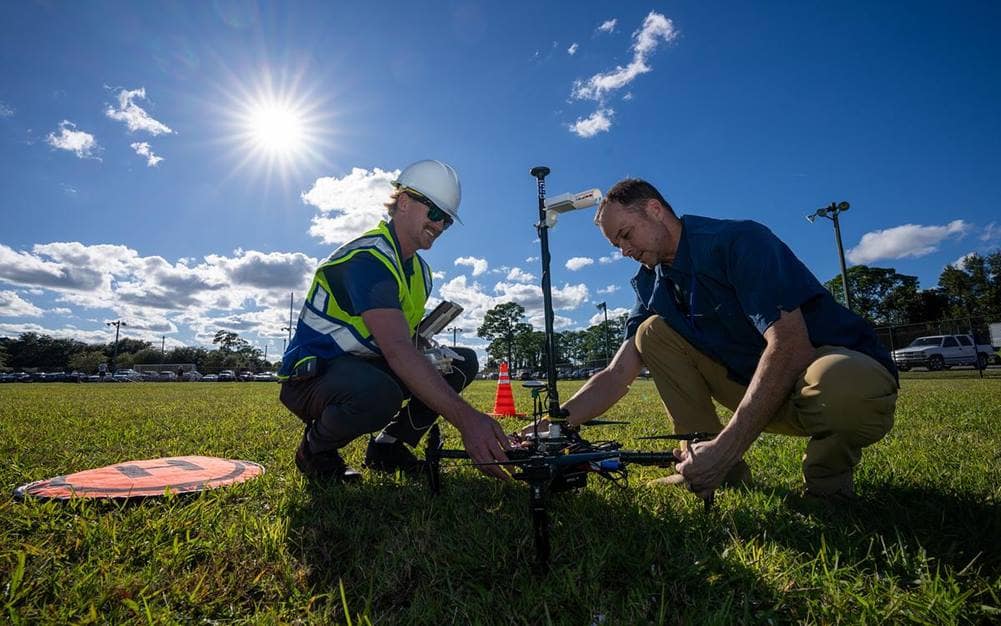
Graduate student Jeremy Copenhaver and Dr. Marc Compere, associate professor of Mechanical Engineering, prepare a drone for launch on Embry-Riddle’s Daytona Beach Campus. (Photo: Embry-Riddle/David Massey)
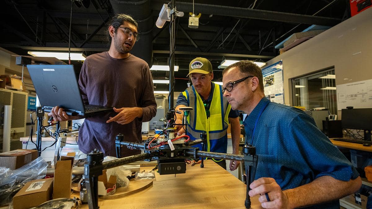
About eight students — some from Embry-Riddle’s College of Aviation, others from the College of Engineering — assisted the team in this research project, which offered them valuable hands-on experience that could open gateways to future careers, as it has for research co-author Krishnan.
“Working on research is predominantly what made me want to keep furthering my education,” said Krishnan, who is now an assistant professor but started working on this project as a master’s student and then a doctoral candidate at Embry-Riddle. “Research is easily the most effective way to gain practical experience and knowledge. Concepts may seem simple when learned in a classroom, but having to practically execute the concept is often quite a challenge.”
Research is also the best way to stay abreast of — and impact — industry trends, he said, adding that his only regret is not starting sooner as an undergrad.
“I still see it as lost time,” he said. “Students should never be afraid to ask a professor to join their research. Not only is it a great way to boost your resume with practical experience, but it also is a good way to meet like-minded individuals.”
Student-researcher Jeremy Copenhaver agreed.
“The experience of working with an elite team and helping develop and confirm new wind data is fascinating,” said the Unmanned Systems master’s student from Wolfeboro, New Hampshire. “Down the road, I want to apply UAS to industry field applications to help develop new solutions for existing problems, as well as help push the technology into new fields.”
Harnessing the Wind
The Wind-Arc method, as it’s called to leverage GPS data in UAS flights, is not new to the industry, but the Embry-Riddle research team has made the tactic more viable through the incorporation of computer simulations. Software is used to forecast flight conditions — including heading angle, airspeed and wind speed trends — and then produce real-time statistics of how an aircraft would respond to nuanced changes in the environment.
“The very nature of wind makes it a difficult quantity to measure,” Compere said. “But our simulation provides an ability that no experimental approach can provide: We can simulate wind with exact known inputs and test the method with exact known outputs.”
Currently, the team uses expensive, custom-built aircraft outfitted with onboard flow sensors to collect weather data, but the process is complex and time-consuming. Those problems go away with the use of GPS, though, and GPS technology comes standard in store-bought drones.

Dr. Kevin Adkins, associate professor of Aeronautical Science, previously collaborated with Dr. Avinash Muthu Krishnan on a project to map drone-delivery routes on Embry-Riddle’s Daytona Beach Campus. (Photo: Embry-Riddle/David Massey)
“Scaling and simplicity is what measuring wind with just a GPS and a compass provides,” Compere said. “All drones already have these sensors. They’re built-in from the factory.”
Adkins added that the GPS approach also opens the possibility of crowdsourcing weather data from multiple users at once.
“The sheer number of potential observations can produce a far superior product, especially in urban environments where things change more quickly,” he said. “The use of GPS makes both business and safety sense.”
In previous work, the team simulated UAS routes along the Daytona Beach Campus to help push drone-delivery tech forward. They also used UAS to monitor and improve air quality, among many other projects.
Next, they’re hoping to commercialize the Wind-Arc Method. A patent is pending.
“Now that we see the need and understand the base concept, we want to grow it further,” Krishnan said. “Publish more. Dig deeper into the original idea and expand it to different applications.”
New Weather Station
To advance their research further, the team is installing a new weather station atop a light pole near the soccer fields this month on campus.
The station, which is specifically designed for drone-based atmospheric testing, will feature a wind speed sensor (anemometer) that measures wind in three directions, offering the team a reference point by which to verify any data recorded by UAS.
“It’s fancy and awesome,” Compere said of the station. “To get scientifically valid measurements, the data collected by those mobile sensors need to be validated against a stable reference instrument.”
The new weather station will provide just that.
“This is how we will continue to publish high-quality journal and conference papers with scientifically valid wind measurements,” Compere said.
Five additional students have assisted in the weather station facet of the project, which began in April 2022.